

Ben More Coigach [Beinn Mhor na Coigich]
Good walks are even better shared.
NC0904 : Ben More Coigach
Colin Smith Photo source
Overview
Ben More Coigach
Ben More Coigach, Beinn Mhòr na Còigich, is a 743.4 m Graham, Marilyn and Simm with 655 m prominence. Its summit windshelter is at NC 09398 04243. It is a different mountain from Ben More near Crianlarich, Ben More on Mull and Ben More Assynt.
The Culnacraig paired circuit
Start at NC061041, the roadside parking area before the descent to Culnacraig. The route crosses Allt nan Coisiche, climbs the western end of Garbh Choireachan and follows the rocky ridge before turning across the plateau to Ben More Coigach’s actual summit. It then curves around the bowl to the bealach and climbs Sgurr an Fhidhleir. Return directly southwest over the broad moorland ridge to the lower path, Culnacraig and the uphill road back to the same parking area.
Walkhighlands publishes 10.5 km, 870 m ascent and 5–7 hours for this two-summit route. These totals exclude the longer Beinn nan Caorach horseshoe, an eastern approach, any bus-stop road walk and the Postman’s Path. Summit-only variants need their own route plan and are not assigned the same totals.
Rock and name
BGS identifies Torridon Group sandstone and glacially sculpted bedrock. The name means “the big mountain of Coigach”; Coigach itself refers to a historic division of land into fifths. The spectacular ridge and the broader highest point are different parts of this mountain, so do not stop at the first ridge top and assume the summit is reached.
Terrain, access and care
The ascent is steep and exposed in places. Bypass paths avoid some harder rock steps, but this remains a serious mountain outing. The burn can become unsafe after rain; cliffs around the plateau and Sgurr an Fhidhleir demand care in mist or strong wind. Allow time for rough, partly pathless ground and the complete return.
The Scottish Wildlife Trust reserve includes working crofted land. NatureScot’s access table, updated 1 September 2026 and checked 18 October 2026, publishes seasonal stalking information. Follow current local notices and reasonable land-manager advice, including any restoration works. A proposal for peatland restoration in 2026–27 does not by itself establish a current summit-route closure.
The coastal Postman’s Path once carried mail to Achiltibuie. SWT warns that this separate route is demanding and difficult in bad weather; it is not a convenient short return linking the western and eastern hill approaches.
Travel and facilities
Service 811 serves the Achiltibuie/Badenscallie area, rather than the Culnacraig start. Confirm the relevant timetable and a workable return arrangement; the additional road walk is not included in the mountain distance. Achiltibuie has a stores and post office, but bring supplies and do not rely on toilets or refreshments at the parking area or on the hill.
Explore routes near Ben More Coigach [Beinn Mhor na Coigich]
Walks starting near this hill. Open a route to check its map, distance and full itinerary.
Fairy Lochs Liberator Wreckage Circuit
View route
Ben Klibreck
View route
Beinn Eighe Lancaster Wreckage at Coire Mhic Fhearchair
View route
Loch Migdale from Torroy: Spinningdale pinewood and loch shore walk
View route
Route planning notes
These notes describe possible approaches. Check a route's map and access information when planning your walk.
Ben More Coigach and Sgurr an Fhidhleir from Culnacraig
Start and finish at the roadside parking area NC061041 before Culnacraig. Walk downhill towards the houses, follow the fence-side path and cross Allt nan Coisiche where conditions allow. Climb the steep western end of Garbh Choireachan and traverse its sandstone ridge, using the north-side bypasses where appropriate. Continue onto the broader plateau and turn towards Ben More Coigach’s summit windshelter at NC 09398 04243. Descend initially southeast and curve around the bowl to the bealach below Sgurr an Fhidhleir; climb its grassy, stony flank. Return directly southwest over the broad moorland ridge, picking up the lower path to Culnacraig, then follow the road uphill to the same parking area. Walkhighlands gives 10.5 km, 870 m ascent and 5–7 hours for this paired circuit. The extra Beinn nan Caorach horseshoe, Postman’s Path and eastern approaches are excluded.
Make a day of it, together
Find someone to share the walk with, or organise a day out along a route you like.
Photo Gallery
View all Photo could not load
NC0904 : Ben More Coigach
Colin Smith
 Photo could not load
NC0904 : View north east from Ben More Coigach
Nigel Brown
 Photo could not load
NC0904 : Ben More Coigach under spring snow
Alan Reid
 Photo could not load
NC0904 : Beinn Mhòr na Còigich (743m)
Mick Garratt
 Photo could not load
NC0904 : The Summit Cairn/Shelter, Beinn Mhòr na Còigich
Mick Garratt
Hill facts and local notes
Classifications
Elevation
743m
2,439 ft
Prominence
655m
Coordinates
57.9865, -5.2257
NC093042
OS Map
15
Explorer: 439W
At the Summit
DoBIH records a windshelter at NC 09398 04243 on the broad summit area, with a surveyed height of 743.4 m. The rocky Garbh Choireachan ridge and Sgurr an Fhidhleir are separate points and should not be mistaken for this summit.
Terrain & Geology
Ben More Coigach is formed of Torridon Group sandstone. BGS fieldwork describes glacially sculpted bedrock on its flanks; the summit ridges and stepped rock are not predominantly quartzite scree.
Views & Scenery
The ridge and summit area overlook Loch Broom and the Summer Isles. An Teallach, the Fannichs and the mountains of Coigach and Assynt are visible in clear weather. Sgurr an Fhidhleir provides a separate viewpoint on the paired circuit.
History & Heritage
Name Origin
Beinn Mhòr na Còigich means “the big mountain of Coigach”. The regional name Coigach means “place of fifths”, referring to an old form of land division.
Historical Significance
The mountain stands within the crofted and wild landscape of the Scottish Wildlife Trust’s Ben Mor Coigach reserve. The separate Postman’s Path along the coast formerly carried mail to and from Achiltibuie; that history belongs to the coastal route, not to a summit path.
Getting There & Facilities
Parking
Use the parking area on the north side of the minor road before it descends to Culnacraig, NC061041, for the described circuit. The turning area at the road end is not the stated parking start. Keep passing places, gates and residents’ access clear; no parking fee is verified.
Public Transport
Service 811 links Ullapool with the Achiltibuie/Badenscallie area, but there is no bus to the listed Culnacraig start. Walkhighlands places Badenscallie about 4 km away. Check the operator’s date-specific timetable, request-stop conditions and last return before planning: do not assume the full mountain circuit fits between buses. Any extra road approach is outside the route totals.
Nearby Facilities
Achiltibuie has a stores and post office. Check current opening and bring food and water for the mountain. No café, public toilet or other serviced facility is verified at the Culnacraig parking area or on the summit route.
Safety Information
Known Hazards
- Allt nan Coisiche can be difficult or unsafe to cross in spate; do not force the crossing.
- Garbh Choireachan is steep and airy, with rocky steps and serious drops. Wet rock, strong wind and ice increase risk even when bypass paths are used.
- Cliffs border the upper plateau and Sgurr an Fhidhleir. Stay back from edges and use careful navigation in poor visibility.
- The descent is rough and partly pathless before the lower path. Carry independent navigation and allow enough daylight for the full return.
- Follow current stalking, crofting and restoration-work notices, keep gates and access clear, and avoid disturbing livestock or wildlife.
- The Postman’s Path is a separate demanding coastal mountain walk, not an easy shortcut back from an eastern approach.
General Safety Tips
- Check weather conditions before setting out
- Carry appropriate clothing and equipment
- Let someone know your planned route
- Take a map, compass, and GPS device
- Carry emergency supplies: food, water, first aid kit, torch
Hills
Some common questions about the hills answered
Are there group walks up Ben More Coigach [Beinn Mhor na Coigich]?
Many walkers use Walkmates to join or organise walks with others. You can check for group walks around Ben More Coigach [Beinn Mhor na Coigich] through the maps
Are there other walkers around Ben More Coigach [Beinn Mhor na Coigich]?
Activity varies by location and time, but Walkmates lets you see whether others have shared walks or shown interest in this area. Find other people through the walking friends search walking friends for Ben More Coigach [Beinn Mhor na Coigich] search or of course create your own walk for Ben More Coigach [Beinn Mhor na Coigich]
Can I organise a walk to Ben More Coigach [Beinn Mhor na Coigich]?
Yes. If there aren’t any walks listed already, you can create a walk and make it available for others to join.
If you're signed up to Walkmates, you can create a walk to Ben More Coigach [Beinn Mhor na Coigich].
How do I find a walk up this hill?
There are often multiple ways to walk this hill, depending on experience and route preference. Walkmates helps you explore walks and routes that others have shared.
Can I suggest a new route up Ben More Coigach [Beinn Mhor na Coigich]?
Yes. You can suggest or create routes to share with others. Walkmates focuses on the social side of walking, so routes are used to help people organise walks and explore areas together, rather than as detailed navigation tools or route libraries.
Other uses really appreciate knowledgeable walkers sharing their routes. Share your favourite route to Ben More Coigach [Beinn Mhor na Coigich] here
The is an error or something incorrect about this hill. How do I let you know?
We always strive to keep the information on Walkmates as accurate as possible. If you find an error, please let us know through the contact form and we'll aim to correct it as quickly as possible
Community Discussion
Comments
Location
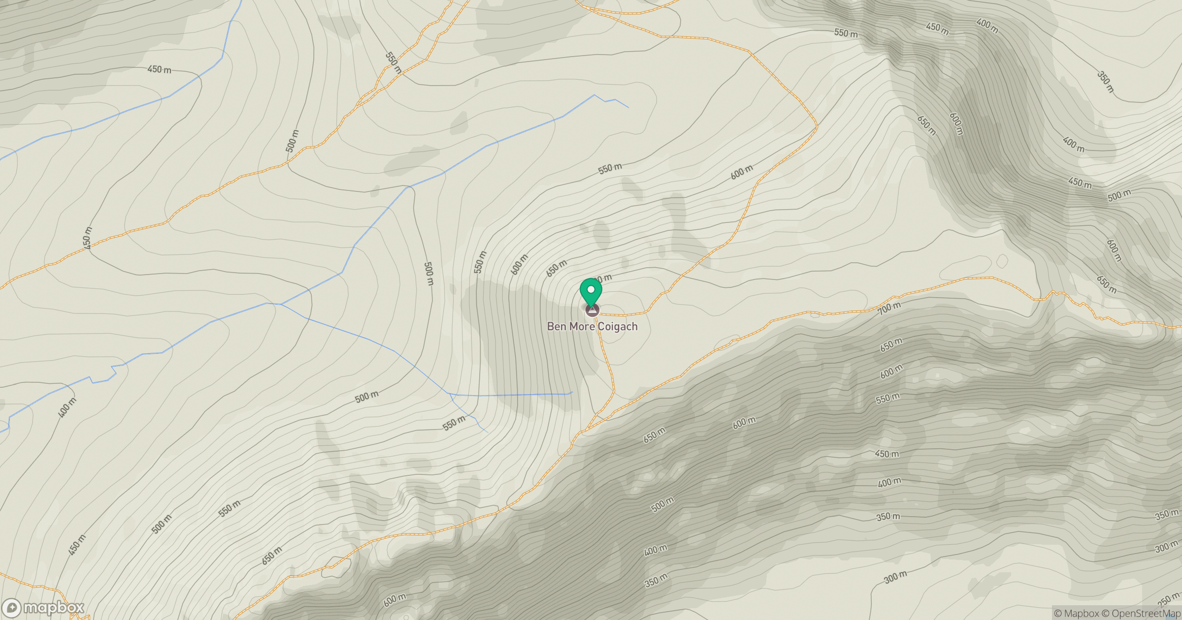
Grid reference: NC093042
View on OpenStreetMapOpens a map in a new tab, centred on the hill.
No comments yet. Be the first.